
The Malvín rambla, 1918
Start from a packed beach in the sixties and rewind: past the home-loan boom, past the horse carts hauling stone along Playa Honda, back to a bay with nothing on it at all. How Montevideo's eastern rambla was built — and the one thing it still doesn't have.
Start with the crowd. Somewhere between 1963 and 1970, a municipal photographer stood above Playa Malvín and shot a coastline in full, ordinary use: cars parked nose-in along the Rambla O'Higgins, the sand below solid with bathers, apartment blocks on the skyline. Hold that frame. Everything in it — the road, the barrio, the crowd — is younger than it looks.
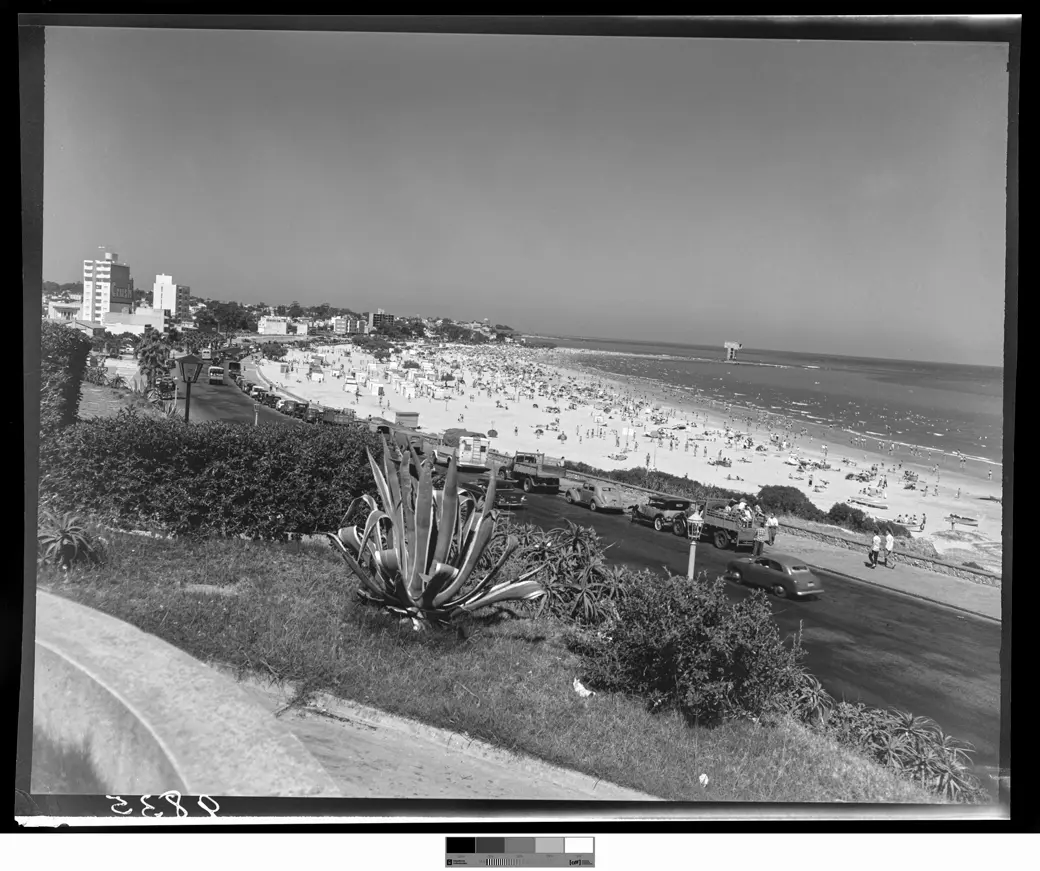
A neighbourhood that began with laundry. The name is a worn-down relic: Juan Balbín González Vallejo, an eighteenth-century Spaniard with a salting plant on this coast, eroded over time into "Malvín." Into the late 1800s this was open land — dunes, sand flats, a saladero or two — beyond the city's eastern limit at the Camino de los Propios, today's Avenida José Batlle y Ordóñez. The neighbourhood's founding transaction was humbler than any seaside dream: in November 1896, the developer Francisco Piria cut some twenty hectares into five hundred plots at a peso a month and sold them to the "gremio de lavanderos pobres" — the poor laundry workers running out of room in Pocitos, which had already become a resort. Free washing rights in the Malbín lagoon were part of the deal. The place was called, accordingly, Lavaderos del Este: the Laundries of the East.
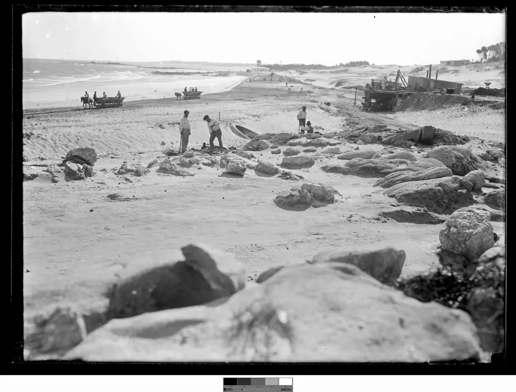
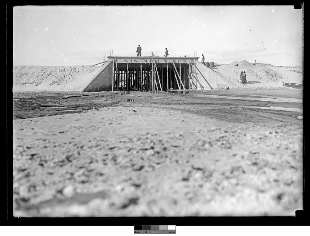
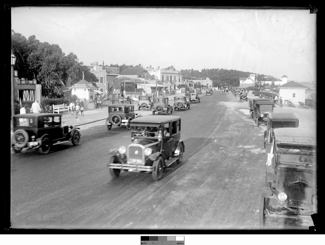
The 1918 campaign. Twenty-two years after those plots were sold, the state came for the shoreline. Under president Feliciano Viera (1915–1919), a Rambla Costanera was authorized from Pocitos to Carrasco — fifty metres wide, nine kilometres long. The Intendencia opened the works in 1917 with the Rambla Este; Malvín's stretch followed in 1918, and the archive's photographers went out to its two work fronts: rough-cut stone hauled by horse cart onto the Playa Honda embankment, and a bridge rising over the mouth of the Arroyo Malvín — the spot that would later become the corner of the O'Higgins and Concepción del Uruguay ramblas. Punta Gorda's works started that same year; Buceo's, in 1920.
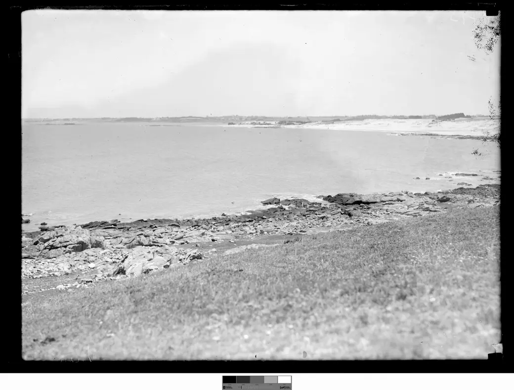
And the year before? The archive kept that too. A 1917 frame shows the Malvín bay with Playa Honda at its right edge and not a metre of rambla anywhere: rock, grass, a coastline curving on its own. Twelve months separate that photograph from the stone carts. Few cities own such a clean before-and-after of their own shoreline being invented.
Resort, then home. By the late twenties Malvín ranked among Montevideo's leading balnearios — a run of hotels (the Amazonas, the Argentino, Las Brisas, among others), a tram at the door from 1928, when line 24 was extended to the rambla. What turned the resort into a neighbourhood was mostly credit: the "ley Serrato" let the Banco Hipotecario lend workers and employees up to the full value of a house, and cheap land did the rest. The mix that moved in — labourers who rented, public employees who financed a house through the bank, summer visitors who stayed — remained legible in the barrio for decades. Then the view itself changed: from the 1970s, a wall of high-rises along the waterfront took the water from the rest of the barrio, and many of the old bars, corner shops and neighbours went with it.
The English beach, briefly. One cove east, toward Punta Gorda, the Playa de los Ingleses keeps the memory of the 1807 English invasion. The scholarly account has Auchmuty's troops landing near Punta Gorda that January and winning their first engagement by the Pérez mill; a local tradition puts the main landing at Buceo instead, with the first clash at the Magariños saladero in present-day Malvín. Both versions end the same way, at El Cardal. The toponym survived — and so, in part, did Juan María Pérez's mill, restored, municipal property since 1958.
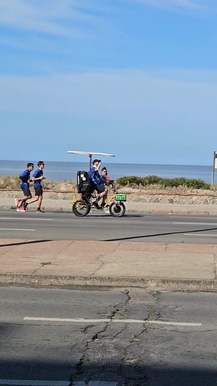
The road that finished, and the lane that hasn't. The rambla-as-road completed its journey in 1952, when the final stretch reached the Arroyo Carrasco at the departmental limit — thirty-four years after Malvín's stones went in. The cycling network has yet to start that trip: along the whole eastern seafront there is still no continuous protected infrastructure for bicycles. The crowd in that sixties photograph got its road, its beach and its barrio. The continuous eastern bike lane still hasn't been built.
- "Barrio Malvín." Centro de Fotografía de Montevideo (Proyecto Nosotros) — the origin of the name, Piria's subdivision, the ley Serrato, the start of works in 1917–1918 and the barrio's transformation. Read the page. Accessed 10 · NOV · 2026
- "Mediadores urbanos: experimentaciones metaproyectuales en la Rambla de Montevideo." Eduardo Bertiz, doctoral thesis, FADU-Udelar, 2025, Part 2, §8.1.2–8.1.3 ("La Rambla de Malvín (1918)" and "La Rambla de Punta Gorda (1918)") — Viera's authorization, the stages of the works, the 1807 English invasion. Read the thesis. Accessed 10 · NOV · 2026
- "Record 02096FMHGE." Centro de Fotografía de Montevideo — the construction of the bridge over the Arroyo Malvín at its mouth. Read the catalogue record. Accessed 10 · NOV · 2026
- "La playa de los Ingleses y algo de historia." MIL Palabras (Héctor Tito López, 2017) — the alternative account of the 1807 English landing. Read the article. Accessed 10 · NOV · 2026
All five photographs are public-domain (CC0) records from the Centro de Fotografía de Montevideo (CdF), Fondo Municipal Histórico.