
Montevideo prepares Avenida Rondeau for the first stretch of its planned cycleway to the Cerro
Night milling on Avenida Rondeau was scheduled from 20 October 2026, and by the 22nd half the roadway was coned off: the first road work for the cycleway to the Cerro.
Montevideo's city government scheduled road works on Avenida General Rondeau for the evening of 20 October 2026: a crew milling five centimetres off the asphalt by night, so that a new surface can be laid by day, on the streets where the cycleway to the Cerro is meant to begin.1 The city's notice is careful with its words. These are repairs to prepare the road surface for a future cycle lane, a ciclovía in Uruguayan Spanish. The lane itself, with its paint, signs and whatever separates it from traffic, comes later. By Thursday 22 October, near Plaza Cagancha, half the avenue was coned off. What exists this week is a coned-off street and a published route.
The street first. The works, by the contractor CVC under the city's road-construction service, cover Rondeau between Plaza Cagancha and General Aguilar, then short stretches of Aguilar, Paraguay and General Luna.1 That is the city's revised notice of 21 October; earlier versions of the notice named General Caraballo as the end of the works, and several press reports reprinted that. An estimated four nights of milling, from eight in the evening to five in the morning, then about two weeks of daytime paving of a strip 2.5 metres wide. While that lasts, parking is banned on the west side of Rondeau between Aguilar and La Paz and between Cerro Largo and Plaza Cagancha, and on the west side of Avenida Libertador between Galicia and Cerro Largo. On Rondeau between Caraballo (a cross street the notice still names, one block short of Aguilar coming from the plaza) and Cerro Largo, the notice makes the ban permanent: that parking lane is where the two-way cycle lane will go. It does not say what happens to parking between Caraballo and Aguilar, where the lane also runs. On the outbound stretch nearest 18 de Julio, cars will park again once the lane has been signed, but alongside it, as they already do on calle Carlos Quijano.1 Rubbish containers and loading bays are relocated along Cerro Largo and 18 de Julio. The city's traffic account, on X on 20 October, put the end of the works at about 6 November.5 The notice gives no budget and no completion date for the route as a whole.
The route, as far as it goes. This is the first time the city has described any of it street by street. The lane will start on Avenida 18 de Julio at Plaza Cagancha, the square where the avenue meets Rondeau, and run up the west side of Rondeau to General Aguilar. It then follows the north side of Aguilar to Paraguay, the west side of Paraguay to General Luna, and the north side of Luna to Jujuy, where the description ends.1 Two-way throughout. The city gives no length; along those streets, OpenStreetMap makes it about 2.6 km.
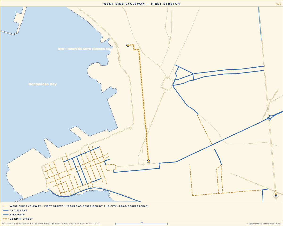
Key
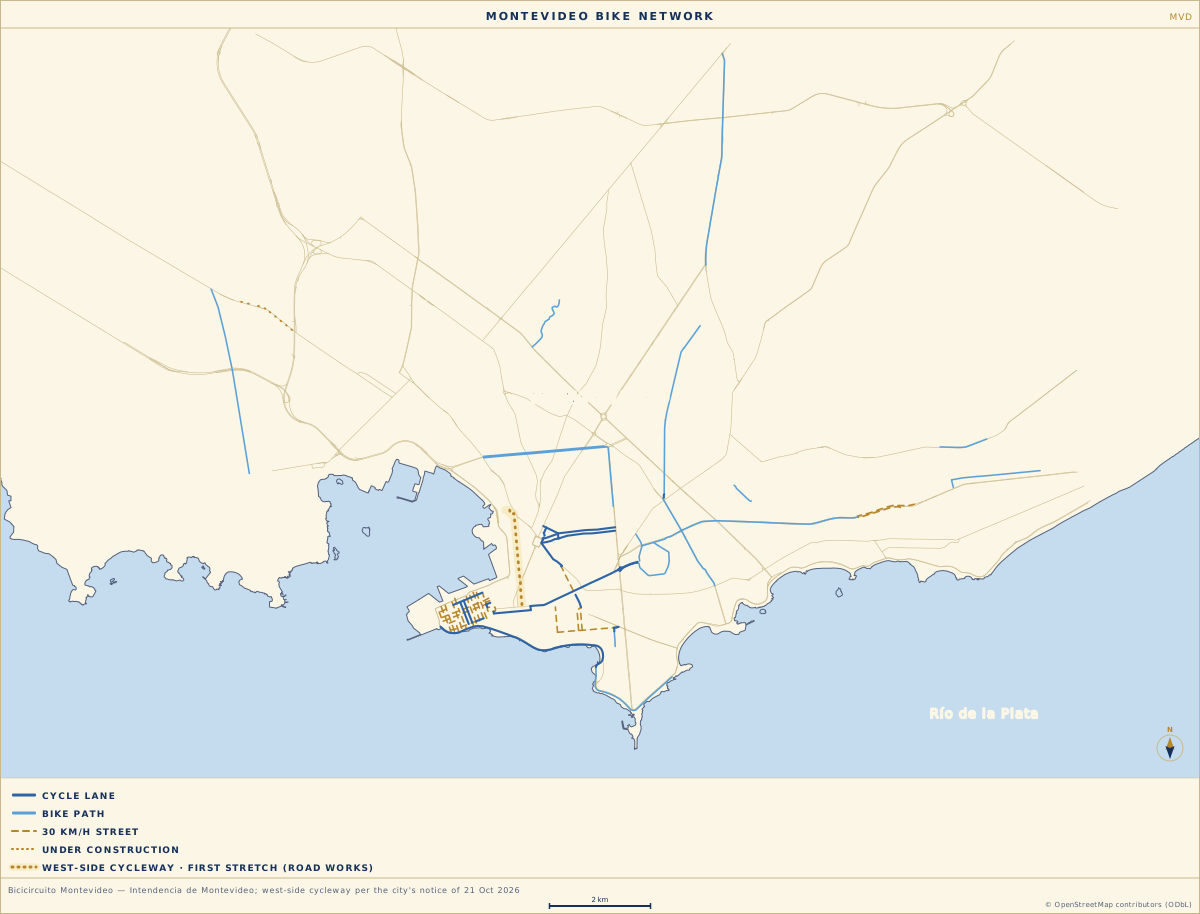
Why a newcomer should care. The Cerro is the hill district on the far side of Montevideo's bay, and on the city's own inventory no cycle lane links it to the centre. A route to it was the first project the current administration named, in November 2025,4 and in May 2026 the city said construction would begin that year:3 roughly 11 km, two-way, from the centre to the Cerro, within a plan to take the network from 78 to 100 km by the end of its term.1 Between May and October that was a promise with a sketch. Rondeau is where the first cones went down.
The open end. The description stops at Jujuy because the city's description does. The city says it is "still working on the definition" of how the lane will join Avenida Carlos María Ramírez toward the Cerro, and the existing path along Avenida Cibils out to Paso de la Arena.1 Its own public map of cycle infrastructure shows none of the four streets, among existing infrastructure or works in progress.2 So the map above ends where the city's words end. Two dates follow. Early November is when the new surface is due, and when it will be clear whether paint and signs arrive with it. The second date has not been set, and it is the one that decides whether this is a cycleway to the Cerro or a cycleway in the centre: the day the city publishes a line from Jujuy to the far side of the bay.
- Intendencia de Montevideo. Acondicionamiento de la Av. Gral. Rondeau para futura ciclovía. montevideo.gub.uy, 19 Oct 2026 (updated 21 Oct 2026).Accessed 22 · OCT · 2026
- Intendencia de Montevideo. Bicicircuito Montevideo (Google My Maps).Accessed 20 · OCT · 2026
- El Observador. Intendencia de Montevideo comenzará este año la construcción de la ciclovía al oeste que unirá el Cerro con 18 de Julio. elobservador.com.uy, 4 May 2026 (subscriber article).Accessed 20 · OCT · 2026
- El Observador. Una ciclovía desde el Centro hasta el Cerro: Bergara planea llegar a 100 km de bicisenda en Montevideo. elobservador.com.uy, 17 Nov 2025.Accessed 20 · OCT · 2026
- El Observador. Cortes de tránsito en Montevideo en vivo: calles afectadas y desvíos hoy miércoles 21 de octubre (embeds the @imtransito post of 20 Oct 2026). elobservador.com.uy, 21 Oct 2026 (subscriber article).Accessed 22 · OCT · 2026