The lighthouses of Uruguay's coast, by bike
Five lighthouses stand along Uruguay's shore between Montevideo and Rocha, and together they make a good reason to ride it. Four of them let you climb to the lamp room; one you admire from the ground. They are spread over more than 250 kilometres, so this is no single day's ride. Treat it as a thread to follow in stages. Here's which lighthouse is which, which ones you can climb, and how a cyclist gets to each.
Every coast needs a reason to keep going, and lighthouses supply one: each is a landmark you can see coming, a viewpoint once you arrive, and a pin for the next stage. Uruguay has five that matter to anyone riding its shoreline. All are still run by the Armada Nacional, the Uruguayan navy, and they line up west to east from Montevideo's southern tip to Cabo Polonio. You can climb four. The fifth is one to look at. What connects them is the part you ride.
Five lighthouses, west to east
Punta Carretas (Montevideo)
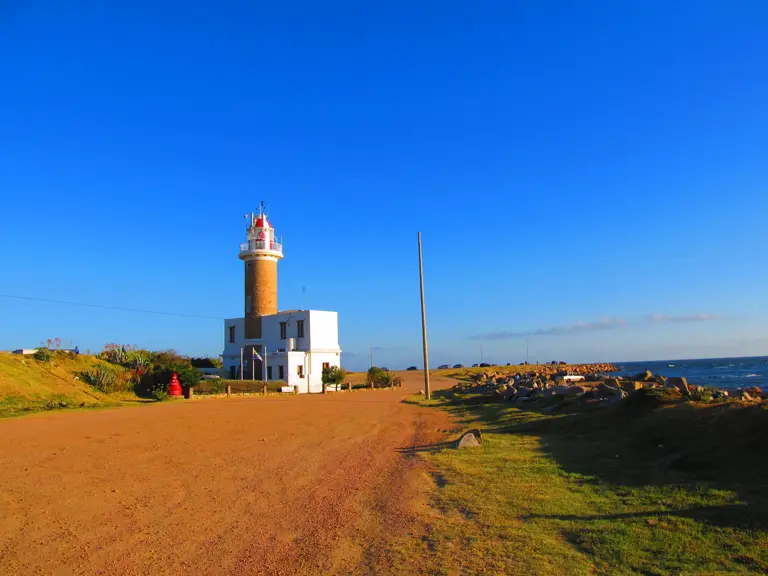
Punta Carretas: the brick tower rises from a white building on the edge of the rocky shore. Photo Elbetobm · CC BY-SA 3.0 · Wikimedia Commons
Locals also call it the Punta Brava lighthouse, after the rocky point it stands on. It was lit in 1876, its tower is 19 metres tall, and it's still in service. For anyone starting in the capital it's the obvious first stop, reached along the rambla, the road and promenade that follow Montevideo's whole waterfront, with a bike lane for part of the way. There's no way up. Enjoy it from the rocks.
Punta del Este (Maldonado)
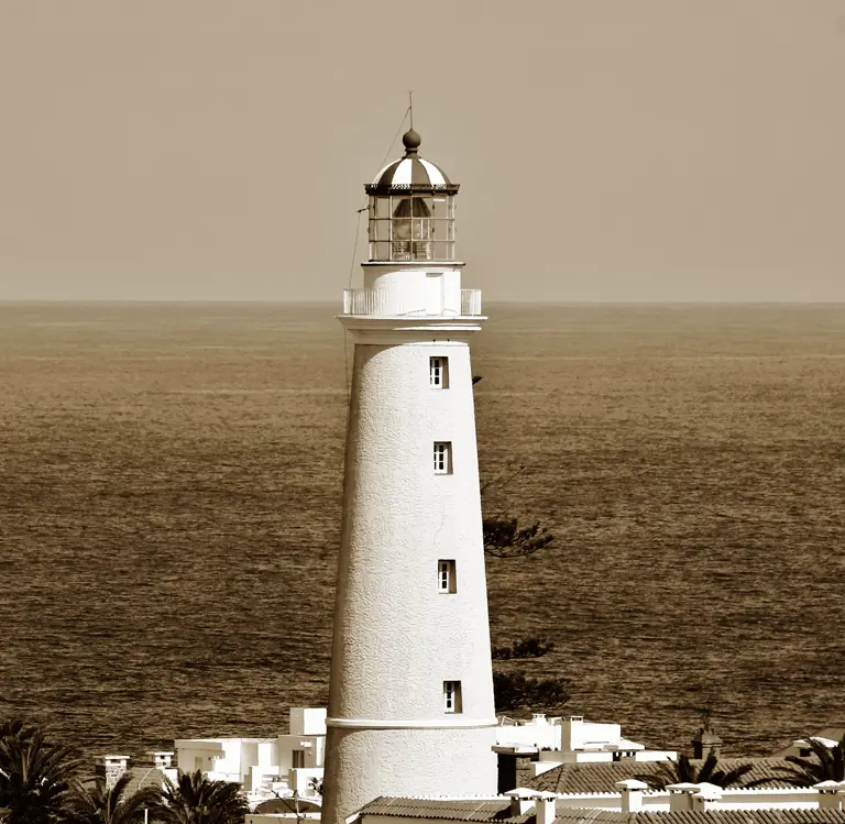
Punta del Este's lighthouse above the town's rooftops, with the sea behind. Photo Juan Pablo240684 · CC BY-SA 3.0 · Wikimedia Commons
The oldest of the five, first lit in 1860. The 25-metre tower was rebuilt in 1923 and is a national historic monument. It's open for guided climbs: 140 steps to a view over the whole Punta del Este peninsula. Visiting days and hours change, so check before you ride out.
José Ignacio (Maldonado)
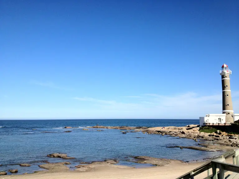
José Ignacio's lighthouse on the rocky point at the far end of a calm bay. Photo Lorisstragliotto · CC BY-SA 3.0 · Wikimedia Commons
Lit in 1877 and declared a national heritage monument in 1970. It's 25 metres tall, although you'll find 45 in some travel guides. You can climb it: 122 steps to a full circle of Atlantic horizon. Entry costs little, and opening hours follow the season.
Cabo Santa María (La Paloma, Rocha)
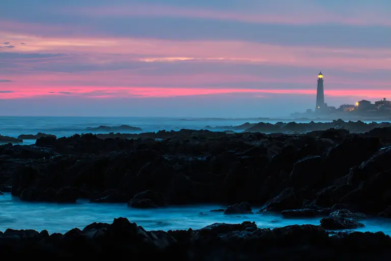
La Paloma at dusk: the lighthouse lit, far off beyond the rocks. Photo Marcelo Campi · CC BY-SA 2.0 · Wikimedia Commons
The first tower here collapsed while it was being built. Its replacement opened on 1 September 1874, and La Paloma counts that day as its own founding date. At 30 metres it's the tallest of the five, a national historic monument, and the emblem of the town. Climbable on weekends: 143 steps up to open ocean.
Cabo Polonio (Rocha)
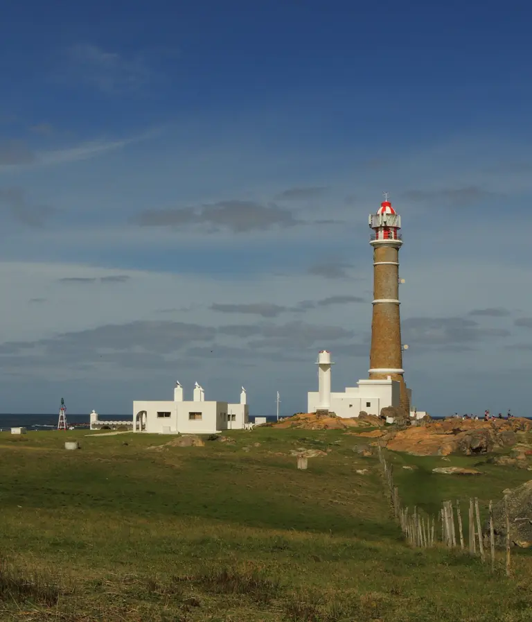
Cabo Polonio: the tower, a smaller white tower and whitewashed houses on the grassy cape. Photo Braveheart · CC BY-SA 4.0 · Wikimedia Commons
The end of the line, lit in 1881: a 26-metre tower on a cape of sand dunes and sea-lion colonies. You can climb it, 132 steps. Getting there is the catch. Cabo Polonio sits inside a national park, and no private vehicles go in. Access is by 4×4 truck across the dunes, from the park gate on Route 10 at kilometre 264.5. Cyclists leave the bike at the gate, ride the truck in and explore on foot. The lighthouse is open to visitors, but you won't be pedalling up to it.
Ride the coast, not just the lighthouses
To be clear about scale: this isn't a day ride or a loop. From Montevideo to Cabo Polonio the five are spread over more than 250 kilometres. Plan them as the spine of a multi-day coastal tour, or pick them off one weekend at a time.
Be realistic about the roads, too. Inside Montevideo the rambla gets you to Punta Carretas, protected for part of the way, though not all of it. East of the city you're on the Ruta Interbalnearia and Route 10: open roads with no bike lanes, shared with cars. Before you set off, know what the law expects of a cyclist sharing those roads, and leave slack in your daily distances. If you need a bike, a handful of outfits rent them and guide rides.
At a glance: the lighthouse route
Look, don't climb. Punta Carretas / Punta Brava (Montevideo, 1876), on the rambla bike lane.
Climbable (check days and hours). Punta del Este (1860, guided, 140 steps) · José Ignacio (1877, 122 steps) · Cabo Santa María, La Paloma (1874, weekends, 143 steps) · Cabo Polonio (1881, 132 steps).
The access catch. At Cabo Polonio, leave the bike at the park gate (Route 10, km 264.5) and cross the dunes by 4×4.
The route. Not a loop: more than 250 km from Montevideo to Rocha. In Montevideo, the rambla, protected in stretches; then the Interbalnearia and Route 10 in mixed traffic. Several days' riding, or separate getaways.
- Wikipedia — Faro de Punta Brava (1876, 19-metre tower, 21-metre focal height).Consulted 23 · SEP · 2026
- Municipio CH (Intendencia de Montevideo) — Faro de Punta Brava (1876, 19 metres, 18.5 nautical miles of range).Consulted 23 · SEP · 2026
- Intendencia de Montevideo — Faro de Punta Carretas (red flash since 1948, the city's southernmost point).Consulted 23 · SEP · 2026
- Wikipedia — Faro de Punta del Este (1860, 25 metres).Consulted 23 · SEP · 2026
- La Nación — Así es vivir y trabajar en el centenario faro de Punta del Este (26 Jan 2025; Thursday–Sunday hours, 140 steps, declared a national historic monument on 30 March 1976, rebuilt in 1923).Consulted 23 · SEP · 2026
- Wikipedia — Faro de José Ignacio (1877, 25 metres, automated in 1983).Consulted 23 · SEP · 2026
- Correo Punta del Este — El faro de José Ignacio cumplió 148 años (2 Jun 2025; 25 metres, 122 steps, low-cost entry, national heritage status since 1970).Consulted 23 · SEP · 2026
- Wikipedia — Faro de Cabo Polonio (May 1881, 26-metre tower, 39.7-metre focal height, national historic monument since 1976).Consulted 23 · SEP · 2026
- Turismo Rocha — Faro de Cabo Polonio (132 steps, low-cost entry, minimum entry age).Consulted 23 · SEP · 2026
- URUBUS — Horarios y costos de camiones a Cabo Polonio (terminal on Route 10, kilometre 264.5, service 6 a.m.–8 p.m.).Consulted 23 · SEP · 2026
- Ministerio de Ambiente — Parque Nacional Cabo Polonio (Decreto 337/2009).Consulted 23 · SEP · 2026
- Wikipedia — Faro de Cabo de Santa María (1874, 30-metre tower, 42-metre focal height, national historic monument).Consulted 23 · SEP · 2026
- Turismo Rocha — Faro Cabo Santa María (143 steps, weekends, built 1870, collapsed April 1872, opened 1 September 1874, the same date as the town's founding).Consulted 23 · SEP · 2026